
Our Towns
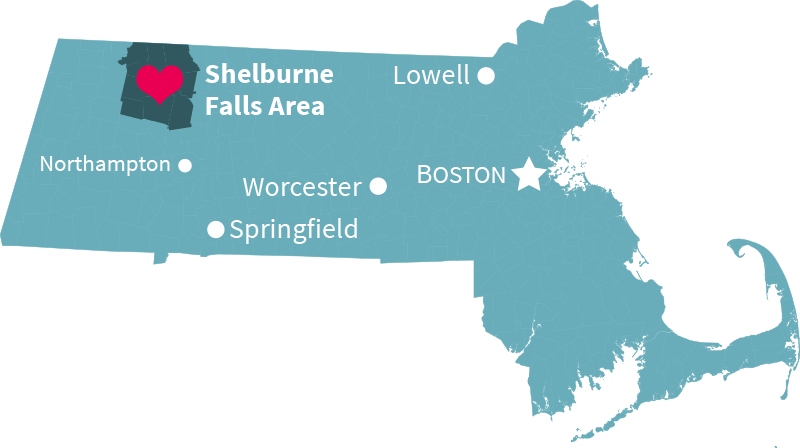 The Shelburne Falls area is located in northwestern Massachusetts, about 2.5 hours (120 miles) west of Boston; 3.5 hours northeast of New York City; one hour north of Springfield; and just east of the Berkshires. Take the scenic route west from Boston on Route 2, and you'll find us on the historic Mohawk Trail—one of the most beautiful drives in New England.
Learn more about our picturesque towns below.
Jump to: Ashfield · Buckland · Charlemont · Colrain · Conway · Hawley · Heath · Plainfield · Rowe · Shelburne
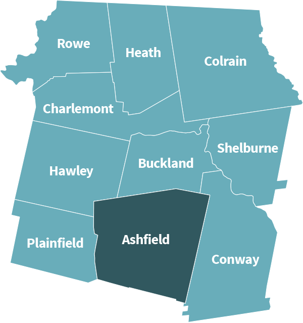
 Ashfield
According to the United States Census Bureau, the town has a total area of 40.4 square miles (104.7 square kilometers), of which, 40.3 square miles (104.4 square kilometers) of it is land and 0.1 square miles (0.3 square kilometers) of it (0.30%) is water. Ashfield is located in the southwest corner of Franklin County, along the Hampshire County line. Ashfield is bordered by Buckland to the north, Conway to the east, Goshen to the south, Cummington to the southwest, Plainfield to the west, and Hawley to the northwest. Ashfield is fifteen miles west-southwest of Greenfield, thirty-five miles north-northwest of Springfield, and 105 miles west-northwest of Boston.
For more info, please visit the Ashfield town website.
Ashfield Historical Society
The Ashfield Historical Society was formed in 1961 to collect, preserve, and present material related to the history of Ashfield, The society operates as a public charity, run mostly by volunteers.
Our museum collection includes more than 5,000 objects, a reference library, and the Howes Brothers' photographic collection of over 23,000 glass negatives. The building itself was used as a store during most of the years since 1830. The store was a base for equipping peddlers with essences from the oils of spearmint, peppermint, spruce, tansy, wintergreen, and other native plants. The room in the front of the building has been restored to recreate an 1850's general store. Other rooms exhibit a kitchen, parlor, bedroom, and children's room. The barn behind the museum contains a 1904 fire hose cart, a horse drawn sleigh, a snow roller, and various tools and implements.
Our museum is open to the public at certain times and appointments may be made for research purposes. The Society sponsors the annual Ashfield Fall Festival as well as a variety of fund-raising projects such as bake sales, raffles, pancake breakfasts, and concerts.
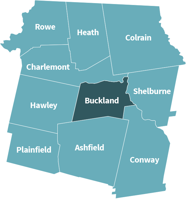
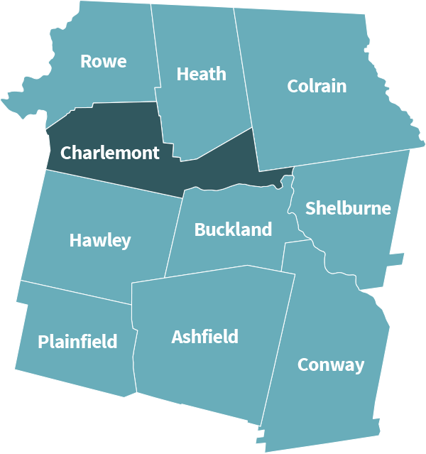
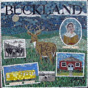 Buckland
The Town of Buckland is a small, rural, predominantly agricultural community with a population of approximately 2,000 people. The main employer in Buckland is the Mohawk Trail Regional School. Buckland shares a downtown business district, known as Shelburne Falls, with the Town of Shelburne. The Route 112 corridor bisects the town and is a scenic highway consisting of a number of small farms and open space. Originally part of the towns of Charlemont and Ashfield, Buckland’s first settlers arrived in 1742. By 1779, the residents of what is now Buckland found it inconvenient and sometimes dangerous to cross the Deerfield River to attend church, school and town functions in Charlemont and surrounding towns, so they petitioned the General Court for incorporation. The Town of Buckland was incorporated April 14, 1779.
For more information, please visit the Buckland town website.
Buckland Historical Society
The Buckland Historical Society museum, located in Buckland village, offers a glimpse into this community's past through antiques, photography, and other memorabilia. The Historical Society owns the Wilder Homestead, which is a fully-preserved 1790s-era house that remained in the same family until it was deeded in the 1990s.
To find the Museum, take Route 112 south to Upper Street; the building is at the corner of Upper Street and East Charlemont Road. The Wilder Homestead is on Route 112. Signs are put along the way when the museum is open. The Museum and Wilder Homestead are both open to the public, free, on the 2nd and 4th Sundays of July and August from 2 to 4pm and by appointment, 413 625-9763.
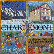 Charlemont
The town of Charlemont is a hilltown community of about 1,300 residents located along the Deerfield River and the scenic Mohawk Trail in northwestern Massachusetts.
Settled in 1744, Charlemont covers 26 square miles and is still home to working farms and cottage industries as well as many recreational opportunities from whitewater rafting to downhill skiing.
For more information on our current events, town government information, and recreational opportunities please visit the Charlemont town website.
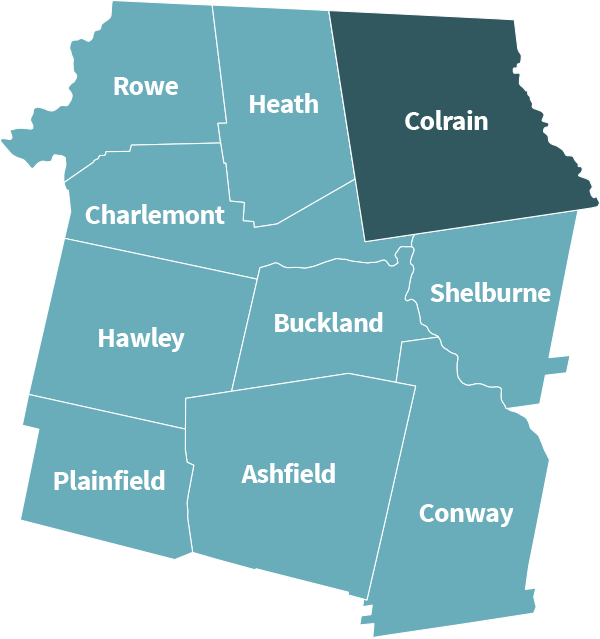
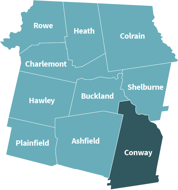
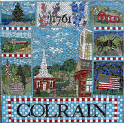 Colrain
Small businesses can be found in Colrain, which was once popular for its factories and mills. Colrain is located directly north of Shelburne Falls.
For more info, please visit the Colrain town website.
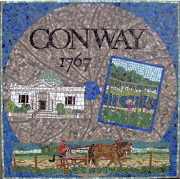 Conway
The Town of Conway (37.8 square miles) lies in the foothills of the Berkshires just west of the Connecticut River Valley, a region rich in agriculture. It is the 4th largest in area of all towns in Franklin County and is the 11th most populous (1990 census). Conway shares boundaries with seven other towns: Buckland and Shelburne Falls to the north, Deerfield to the east and north, Whately and Williamsburg to the south, and Ashfield and Goshen to the west. It is the first hilltown northbound on State Route 116.
For more info, please visit the Conway town website.
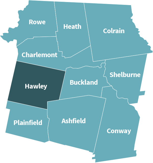
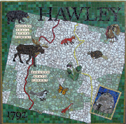 Hawley
The Town of Hawley, Massachusetts was founded in 1792 and is located in Franklin County. Hawley consists of about 340 year round residents and is one of the most wintry towns in Massachusetts. The town has no stores and no industry, but it does contain limited potato and dairy farms. Hawley is the home of a true volunteer government.
For more info, visit the Hawley town website.
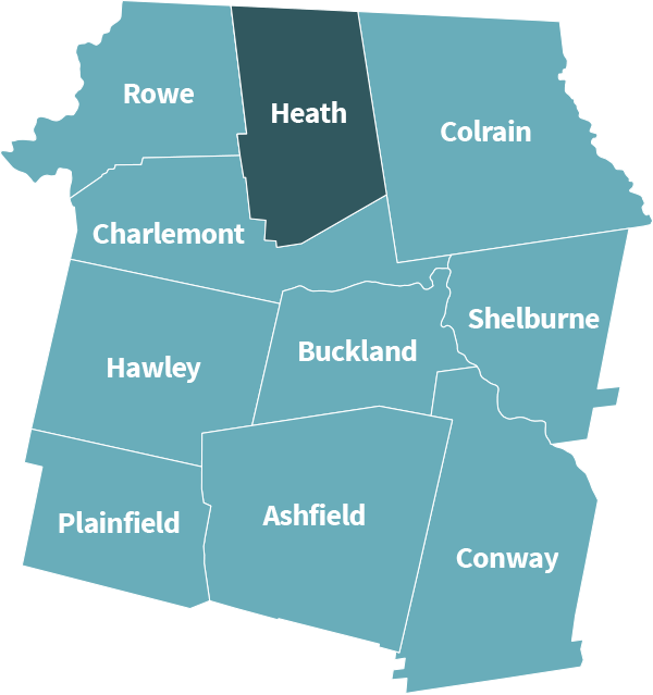
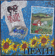 Heath
Heath
Heath, incorporated in 1785, is named after Revolutionary War General William Heath. The town comprises a total area of 24.9 square miles with a population of 706. It is a “Right To Farm Community” with rolling hills, stone walls, forests and streams. The Heath Agricultural Society Fair, held two weekends before Labor Day annually, features a chicken barbecue, animal events, live music and lots of fun for young and old alike.
For more info, please visit the Heath town website.
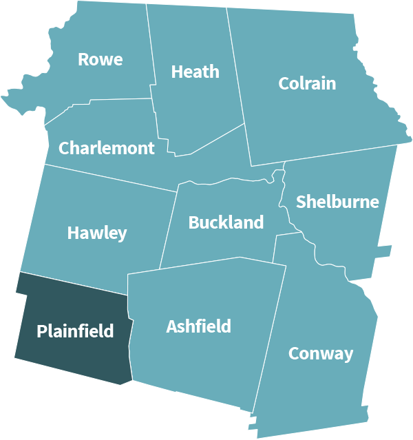
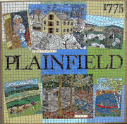 Plainfield
The Town of Plainfield, Massachusetts was founded in 1807 and is located in Hampshire County. Plainfield contains about 600 year-round residents. Those in the area are encouraged to stop at the Deer Hill State Reservation as well as the Dubuque Memorial State Forest for a relaxing day outdoors. Enjoy the cool breeze and scenic views of Plainfield.
For more info, please visit the Plainfield town website.
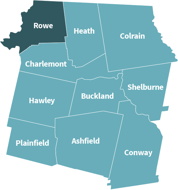
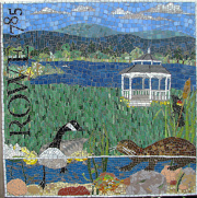 Rowe
Rowe
Rowe is a small hilltown in northwestern Massachusetts, bordered on the north by Whitingham, Vermont. It is nestled in an area of scenic beauty, with wooded mountains, clear brooks and the Deerfield River on its western border. Rowe is close to ski areas and enjoys great hiking, fishing, hunting, canoeing, kayaking and zip lining. The Rowe Historical Society maintains an excellent small historical museum, containing antiques, artifacts and numerous photographs documenting the history of the town, including the construction of the Hoosac Tunnel, and the operation of both the Davis Mine and the recently-decommissioned Yankee Nuclear Power Station. The close knit community enjoys a solid tax base provided by several hydro-electric facilities located in Rowe on the Deerfield River.
For more info, please visit the Rowe town website.
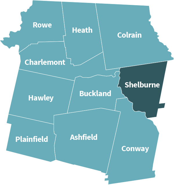
 Shelburne
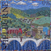
Shelburne was first settled in 1756 as part of Deerfield, Massachusetts known then as “Deerfield Northwest.” It was initially organized as the district of Shelburne in 1768 (named in honor of William Petty, 2nd Earl of Shelburne), and was officially incorporated as a town in 1775.
For more info, please visit the Shelburne town website.